FacilMap
-
I am the developer of FacilMap, an open-source application based on the OpenStreetMap ecosystem that is useful for finding places, calculating routes and collaboratively creating shareable maps of markers, lines and routes.
It would be nice to see FacilMap available in Cloudron. FacilMap is running on Node.js and uses a MySQL or PostgreSQL database for storage. There is a Docker image available, the instructions how to use it are here.
@cdauth That looks very nice and valuable for self hosting... The Dockerfile seems to be straight forward...
Github Link: https://github.com/FacilMap/facilmap
-
Main Site: https://facilmap.org/
Licence: AGPL v3.0
Demo: main site
Docker: Yes
OSM: https://forum.cloudron.io/topic/8303/openmaptiles-on-cloudron-host-your-own-osm-open-street-map?_=1712223703215
Open Routing: https://forum.cloudron.io/topic/2912/open-source-routing-machine?_=1712223738198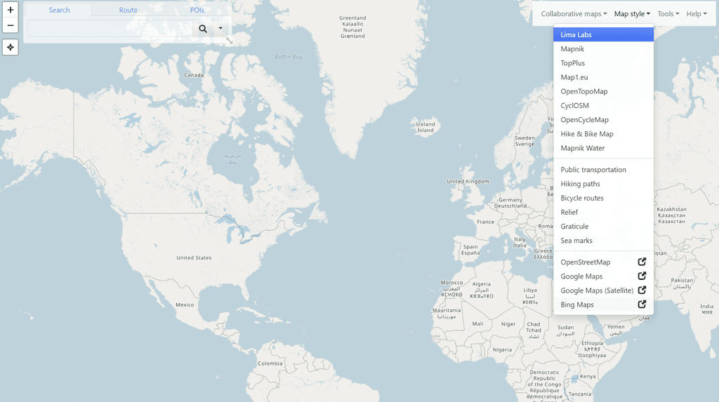
Fantastic! I hadn't heard of this project and am delighted to see it here. Even more brilliant, the maintainer has actually visited us to suggest support on Cloudron. What a great start to a day!
First, I certainly hope FacilMap is supported on Cloudron as soon as possible. We are most fortunate, as one of our best packagers,@Kubernetes likes the look of it, too.
If you don't mind, I have some questions for you, both about FacilMap and about Cloudron.
Firstly, thank you for making FacilMap. There are some nice features on there, like straight line measurements, topography and English versions of foreign names. Do you think it might be possible to integrate public-transport routing into this at some stage? Perhaps you are familiar with the Open Source projects working on things like that. What is the future for FacilMap and the Open Street Map project in general?
Can we customize the level of resolution for different parts of the world on FacilMaps? For example, if we live in Antarctica and want to be able to see every nook and cranny, but don't care about Greenland and are ok with providing much lower resolution tiling there, can that be easily configured? What hardware would really make FacilMap run snappily? How much storage can we expect to need?
I think a lot of us would like to know how you discovered Cloudron and what prompted you to have this project supported here? Have you actually used Cloudron to deploy other applications and seen how easy it is? Later on, it would be nice to hear if you would recommend Cloudron to other developers. Also, I hope you know some other good projects and make a request for them as well.
-
Main Site: https://facilmap.org/
Licence: AGPL v3.0
Demo: main site
Docker: Yes
OSM: https://forum.cloudron.io/topic/8303/openmaptiles-on-cloudron-host-your-own-osm-open-street-map?_=1712223703215
Open Routing: https://forum.cloudron.io/topic/2912/open-source-routing-machine?_=1712223738198Fantastic! I hadn't heard of this project and am delighted to see it here. Even more brilliant, the maintainer has actually visited us to suggest support on Cloudron. What a great start to a day!
First, I certainly hope FacilMap is supported on Cloudron as soon as possible. We are most fortunate, as one of our best packagers,@Kubernetes likes the look of it, too.
If you don't mind, I have some questions for you, both about FacilMap and about Cloudron.
Firstly, thank you for making FacilMap. There are some nice features on there, like straight line measurements, topography and English versions of foreign names. Do you think it might be possible to integrate public-transport routing into this at some stage? Perhaps you are familiar with the Open Source projects working on things like that. What is the future for FacilMap and the Open Street Map project in general?
Can we customize the level of resolution for different parts of the world on FacilMaps? For example, if we live in Antarctica and want to be able to see every nook and cranny, but don't care about Greenland and are ok with providing much lower resolution tiling there, can that be easily configured? What hardware would really make FacilMap run snappily? How much storage can we expect to need?
I think a lot of us would like to know how you discovered Cloudron and what prompted you to have this project supported here? Have you actually used Cloudron to deploy other applications and seen how easy it is? Later on, it would be nice to hear if you would recommend Cloudron to other developers. Also, I hope you know some other good projects and make a request for them as well.
Sorry for the late reply, I only saw your responses now. I guess I have to turn on notifications somehow.
@LoudLemur said in FacilMap:
Do you think it might be possible to integrate public-transport routing into this at some stage? Perhaps you are familiar with the Open Source projects working on things like that.
When it comes to the services that require a lot of server resources (such as map tiles and routing), FacilMap only embeds third-party services, since I don't have the funds to host all that myself. If you know a good public-transport routing service, I could look into embedding it, but so far all services (even commercial ones) that I have come across were so terribly bad that I felt like it's better to not include such a feature rather than it giving false information.
@LoudLemur said in FacilMap:
What is the future for FacilMap and the Open Street Map project in general?
I cannot say much about OpenStreetMap in general, other than that it has become quite mainstream in western countries in the last years. Many companies and government agencies have started to use it and sometimes support it by donating money or data. In western countries the quality of the map is often better than that of commercial maps at least in those places where you can go by car. Where it lacks a lot of detail is details about businesses (since those often add their information themselves, but only to Google Maps) and about tracks and paths in less frequented rural areas. Where it exceeds commercial maps is any kind of non-commercial or non-car infrastructure, such as bike/foot paths and public amenities (drinking water, public toilets, waste bins, etc.) In non-western countries the map nowadays contains many features that can be seen on satellite images, but often lacks information that can only be learned on the ground, such as street names, road quality and restrictions, and amenities. There are some exceptions where government agencies have donated official data to OSM. When it comes to routing, compared to commercial maps, OpenStreetMap lacks the data sources of actual travel times, so its route predictions are often less accurate and don't take traffic fluctuations into consideration. About the future of OSM I would say that it continues growing both in popularity and in detailedness of the map. Notably, in the last years some popular commercial apps/services have started using OSM and include functionality to let users report map errors or correct them, which has provided greatly to the up-to-date-ness of the map.
About FacilMap, it is my hobby project and I currently do not have a lot of time to work on it other than fixing bugs, keeping the software stack up to date and occasionally introducing small features. I do have some bigger plans for it (provide a more extensive public API, introduce some more sophisticated permission management, add support for live navigation and user position tracking, add more features to analyse and modify routes and recorded tracks. But I don't know at what point I will have time to implement those. I have been developing FacilMap since 2009, sometimes more, sometimes less actively, and it remains my main open-source project that I’m also personally using on a daily basis. FacilMap is deeply rooted in the values of open-source software. While I like the imagination of getting enough donations to be able to work on FacilMap as my main job, I am strictly opposed to the idea of making it into a commercial project where decisions are made on profit rather than on user needs.
@LoudLemur said in FacilMap:
Can we customize the level of resolution for different parts of the world on FacilMaps? For example, if we live in Antarctica and want to be able to see every nook and cranny, but don't care about Greenland and are ok with providing much lower resolution tiling there, can that be easily configured?
This cannot be configured right now. Since FacilMap doesn't generate any tiles itself but only uses tiles from third-party providers, reducing the resolution of tiles in certain areas wouldn't have any benefit to the user. There are some ideas for small improvements that might improve this use case though:
- Add the ability to configure a map boundary. No objects can be added outside the boundary, and areas outside the boundary might be displayed faded out or not at all.
- Add the ability to configure a maximum zoom level higher than what is available as map tiles. This would make it possible to create very detailed maps for very small areas, for example mapping all the amenities on a festival site.
Due to the Mercator projection, using FacilMap in Antarctica or the Arctic would not be very pleasant. If this concrete need ever actually comes up, I would have to think of a good solution for it.
@LoudLemur said in FacilMap:
What hardware would really make FacilMap run snappily? How much storage can we expect to need?
Since the tiles and route calculations happen on third-party services, the FacilMap backend is mostly only responsible serving routes calculated by third-party services and markers/lines/routes that are added to collaborative maps. These are stored in a MySQL or Postgres database. It is hard to give a good estimation what resources are required to host it, since that largely depends on the number of users and amount of data that is stored on collaborative maps. I would say that a minimum of 512 MiB of RAM is required to run the server. The database on facilmap.org, containing all the maps created in the last 15 years, is about 10 GiB big. For a small self-hosted instance I would say 1 GiB of disk space is way enough. I cannot say much about CPU power, I guess not much is needed, but of course the faster the better.
@LoudLemur said in FacilMap:
I think a lot of us would like to know how you discovered Cloudron and what prompted you to have this project supported here?
I don't remember exactly how I discovered Cloudron, but mostly I was looking for easy ways how non-developers could self-host FacilMap. I came across YunoHost and helped to build a FacilMap package for it, but after playing around with it it seems to me that both the architecture and the UI of YunoHost are not very well-designed or stable. So I was looking for more professional alternatives that I can recommend to people who want to self-host FacilMap.
-
Sorry for the late reply, I only saw your responses now. I guess I have to turn on notifications somehow.
@LoudLemur said in FacilMap:
Do you think it might be possible to integrate public-transport routing into this at some stage? Perhaps you are familiar with the Open Source projects working on things like that.
When it comes to the services that require a lot of server resources (such as map tiles and routing), FacilMap only embeds third-party services, since I don't have the funds to host all that myself. If you know a good public-transport routing service, I could look into embedding it, but so far all services (even commercial ones) that I have come across were so terribly bad that I felt like it's better to not include such a feature rather than it giving false information.
@LoudLemur said in FacilMap:
What is the future for FacilMap and the Open Street Map project in general?
I cannot say much about OpenStreetMap in general, other than that it has become quite mainstream in western countries in the last years. Many companies and government agencies have started to use it and sometimes support it by donating money or data. In western countries the quality of the map is often better than that of commercial maps at least in those places where you can go by car. Where it lacks a lot of detail is details about businesses (since those often add their information themselves, but only to Google Maps) and about tracks and paths in less frequented rural areas. Where it exceeds commercial maps is any kind of non-commercial or non-car infrastructure, such as bike/foot paths and public amenities (drinking water, public toilets, waste bins, etc.) In non-western countries the map nowadays contains many features that can be seen on satellite images, but often lacks information that can only be learned on the ground, such as street names, road quality and restrictions, and amenities. There are some exceptions where government agencies have donated official data to OSM. When it comes to routing, compared to commercial maps, OpenStreetMap lacks the data sources of actual travel times, so its route predictions are often less accurate and don't take traffic fluctuations into consideration. About the future of OSM I would say that it continues growing both in popularity and in detailedness of the map. Notably, in the last years some popular commercial apps/services have started using OSM and include functionality to let users report map errors or correct them, which has provided greatly to the up-to-date-ness of the map.
About FacilMap, it is my hobby project and I currently do not have a lot of time to work on it other than fixing bugs, keeping the software stack up to date and occasionally introducing small features. I do have some bigger plans for it (provide a more extensive public API, introduce some more sophisticated permission management, add support for live navigation and user position tracking, add more features to analyse and modify routes and recorded tracks. But I don't know at what point I will have time to implement those. I have been developing FacilMap since 2009, sometimes more, sometimes less actively, and it remains my main open-source project that I’m also personally using on a daily basis. FacilMap is deeply rooted in the values of open-source software. While I like the imagination of getting enough donations to be able to work on FacilMap as my main job, I am strictly opposed to the idea of making it into a commercial project where decisions are made on profit rather than on user needs.
@LoudLemur said in FacilMap:
Can we customize the level of resolution for different parts of the world on FacilMaps? For example, if we live in Antarctica and want to be able to see every nook and cranny, but don't care about Greenland and are ok with providing much lower resolution tiling there, can that be easily configured?
This cannot be configured right now. Since FacilMap doesn't generate any tiles itself but only uses tiles from third-party providers, reducing the resolution of tiles in certain areas wouldn't have any benefit to the user. There are some ideas for small improvements that might improve this use case though:
- Add the ability to configure a map boundary. No objects can be added outside the boundary, and areas outside the boundary might be displayed faded out or not at all.
- Add the ability to configure a maximum zoom level higher than what is available as map tiles. This would make it possible to create very detailed maps for very small areas, for example mapping all the amenities on a festival site.
Due to the Mercator projection, using FacilMap in Antarctica or the Arctic would not be very pleasant. If this concrete need ever actually comes up, I would have to think of a good solution for it.
@LoudLemur said in FacilMap:
What hardware would really make FacilMap run snappily? How much storage can we expect to need?
Since the tiles and route calculations happen on third-party services, the FacilMap backend is mostly only responsible serving routes calculated by third-party services and markers/lines/routes that are added to collaborative maps. These are stored in a MySQL or Postgres database. It is hard to give a good estimation what resources are required to host it, since that largely depends on the number of users and amount of data that is stored on collaborative maps. I would say that a minimum of 512 MiB of RAM is required to run the server. The database on facilmap.org, containing all the maps created in the last 15 years, is about 10 GiB big. For a small self-hosted instance I would say 1 GiB of disk space is way enough. I cannot say much about CPU power, I guess not much is needed, but of course the faster the better.
@LoudLemur said in FacilMap:
I think a lot of us would like to know how you discovered Cloudron and what prompted you to have this project supported here?
I don't remember exactly how I discovered Cloudron, but mostly I was looking for easy ways how non-developers could self-host FacilMap. I came across YunoHost and helped to build a FacilMap package for it, but after playing around with it it seems to me that both the architecture and the UI of YunoHost are not very well-designed or stable. So I was looking for more professional alternatives that I can recommend to people who want to self-host FacilMap.
@cdauth prompted by your recent posts here I had a little play with facilmap.org recently and I love it! Such a great powerful tool! THANK YOU!

There is one (I think relatively easy) thing you could do to (I think) make it even better, which would be to make public maps support the murmurations prototol (which, as I understand it would just be a matter of making it easy to do json export of public map data formatted in such a way as could easily be imported into murmurations indexes)
")
-
I tried packaging this app but failed and gave up.
There seems to be a problem of versions.
Added yarn 3.6.3 and upgraded Node from the base image 18.8.0
Resorted to an AI approach to resolve, but it failed -
Ha !
talk about versions - I was using an old cloudron base image !!
trying again …EDIT : yep, that works.

Will create a repo for other to try if they wish
-
Initial V1 package available here : https://git.cloudron.io/timconsidine/cloudron-facilmap
Indie app dev, huge fan of Cloudron PaaS, scratching my itches : communityapps.appx.uk
-
Initial V1 package available here : https://git.cloudron.io/timconsidine/cloudron-facilmap
@timconsidine said in FacilMap:
Initial V1 package available here : https://git.cloudron.io/timconsidine/cloudron-facilmap

-
Ha !
talk about versions - I was using an old cloudron base image !!
trying again …EDIT : yep, that works.
Will create a repo for other to try if they wish
-
 J jdaviescoates referenced this topic on
-
My original Cloudron-Facilmap package has been re-packaged as a Community App, so available for installation through AppStore "Add a Custom App".
Prior to it being added in @community-apps, you can find it here :
https://communityapps.appx.ukIndie app dev, huge fan of Cloudron PaaS, scratching my itches : communityapps.appx.uk
-
My original Cloudron-Facilmap package has been re-packaged as a Community App, so available for installation through AppStore "Add a Custom App".
Prior to it being added in @community-apps, you can find it here :
https://communityapps.appx.uk@timconsidine thanks, this is going to be the first Community App I give a spin.
BTW, small thing but your https://communityapps.appx.uk/ link appears not to be mobile responsive
-
@timconsidine thanks, this is going to be the first Community App I give a spin.
BTW, small thing but your https://communityapps.appx.uk/ link appears not to be mobile responsive
@jdaviescoates good luck with trying it, hope you like it.
I will fix the mobile responsive view, thanks for letting me know.

Hello! It looks like you're interested in this conversation, but you don't have an account yet.
Getting fed up of having to scroll through the same posts each visit? When you register for an account, you'll always come back to exactly where you were before, and choose to be notified of new replies (either via email, or push notification). You'll also be able to save bookmarks and upvote posts to show your appreciation to other community members.
With your input, this post could be even better 💗
Register Login