OpenDroneMap

-
- https://www.opendronemap.org/
- https://www.opendronemap.org/webodm/download/#installer
- https://demo.webodm.org/dashboard/
- https://github.com/OpenDroneMap/WebODM/ (Docker available)
An Open Ecosystem
We’re building sustainable solutions for collecting, processing, analyzing and displaying aerial data while supporting the communities built around them.
-
Thanks, I wasn't aware of OpenDroneMap.
A huge proportion of internet searches are map related/geographic in nature. We really need to be able to self-host our own maps and decentralize OpenStreetMap.
There is already a request for hosting OSM here. If we could manage the upstream project, it might help cascade a load of downstream projects like ODM too.
https://forum.cloudron.io/topic/5831/openstreetmap-on-cloudron?_=1649753554608 -
Thanks, I wasn't aware of OpenDroneMap.
A huge proportion of internet searches are map related/geographic in nature. We really need to be able to self-host our own maps and decentralize OpenStreetMap.
There is already a request for hosting OSM here. If we could manage the upstream project, it might help cascade a load of downstream projects like ODM too.
https://forum.cloudron.io/topic/5831/openstreetmap-on-cloudron?_=1649753554608@LoudLemur Also found this on my travels too: https://www.maptiler.com/
Will look deeper into that at some point and may also make a Cloudron App for the self-hosted version of that too.
Web Design & Development: https://www.evergreen.je
Technology & Apps: https://www.marcusquinn.com -
@LoudLemur Also found this on my travels too: https://www.maptiler.com/
Will look deeper into that at some point and may also make a Cloudron App for the self-hosted version of that too.
@marcusquinn
Not sure if I'm right, but MapTiler products seem to be mainly closed source.However, they contribute greatly to the open source community:-
https://www.maptiler.com/open-source/Either way, good stuff indeed!
Self-hoster with Cloudron, Hetzner, Exoscale, Porkbun & Gandi
-
@marcusquinn
Not sure if I'm right, but MapTiler products seem to be mainly closed source.However, they contribute greatly to the open source community:-
https://www.maptiler.com/open-source/Either way, good stuff indeed!
There is Qgis which you can populate with data from e.g. the Ordinance Survey:
-
@marcusquinn
Not sure if I'm right, but MapTiler products seem to be mainly closed source.However, they contribute greatly to the open source community:-
https://www.maptiler.com/open-source/Either way, good stuff indeed!
@RoundHouse1924 Yeah, I think mixed, although there's self-hosting options.
-
There is Qgis which you can populate with data from e.g. the Ordinance Survey:
@LoudLemur Nice find! My specific interest is 3D "scanning" with drones to measure and survey land and buildings, but all things mapping are cool eh!
-
 M marcusquinn referenced this topic on
-
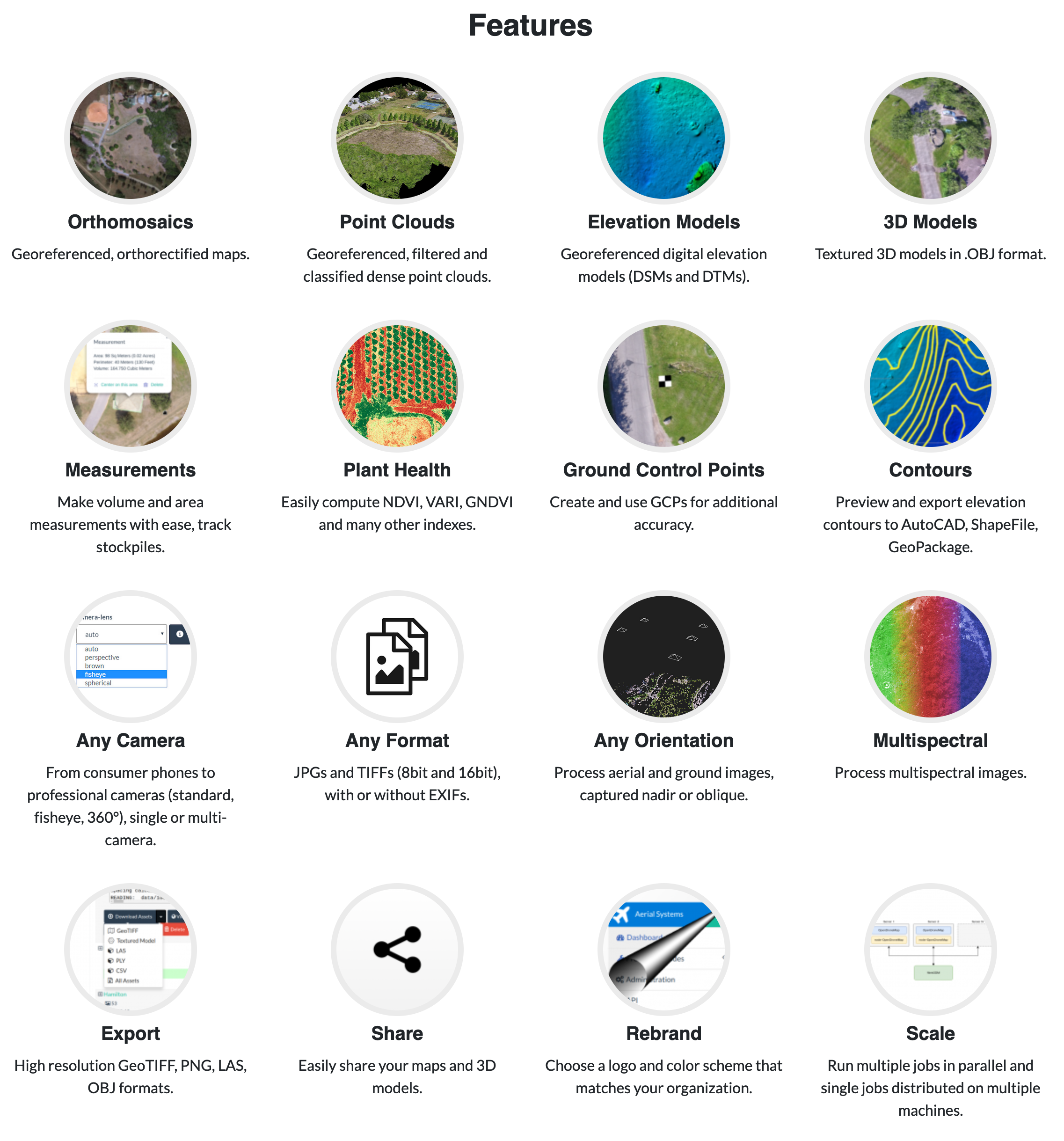
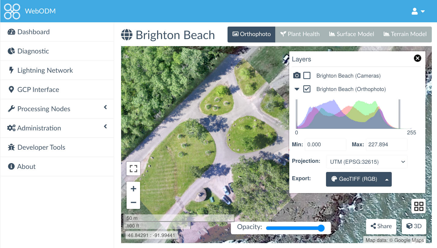
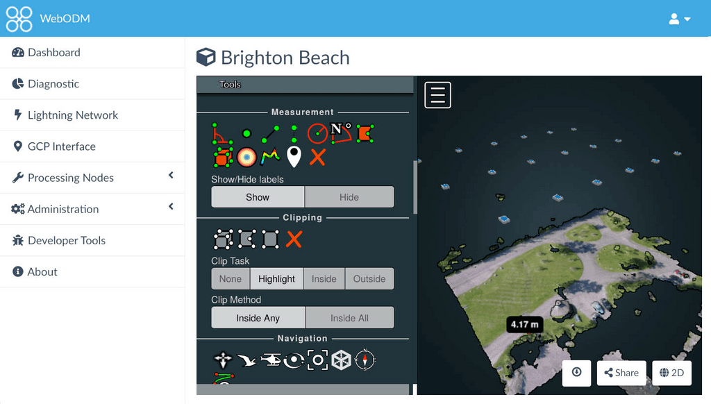
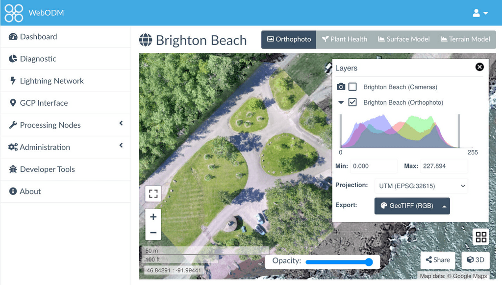
I've started using WebODM this year and it is amazing, would love to see this on cloudron.
Hello! It looks like you're interested in this conversation, but you don't have an account yet.
Getting fed up of having to scroll through the same posts each visit? When you register for an account, you'll always come back to exactly where you were before, and choose to be notified of new replies (either via email, or push notification). You'll also be able to save bookmarks and upvote posts to show your appreciation to other community members.
With your input, this post could be even better 💗
Register Login